PricesFSP6 Map
 |
20 |
01/01/9999 midnight |
FSP |
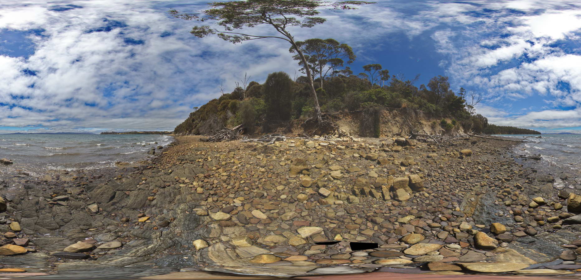
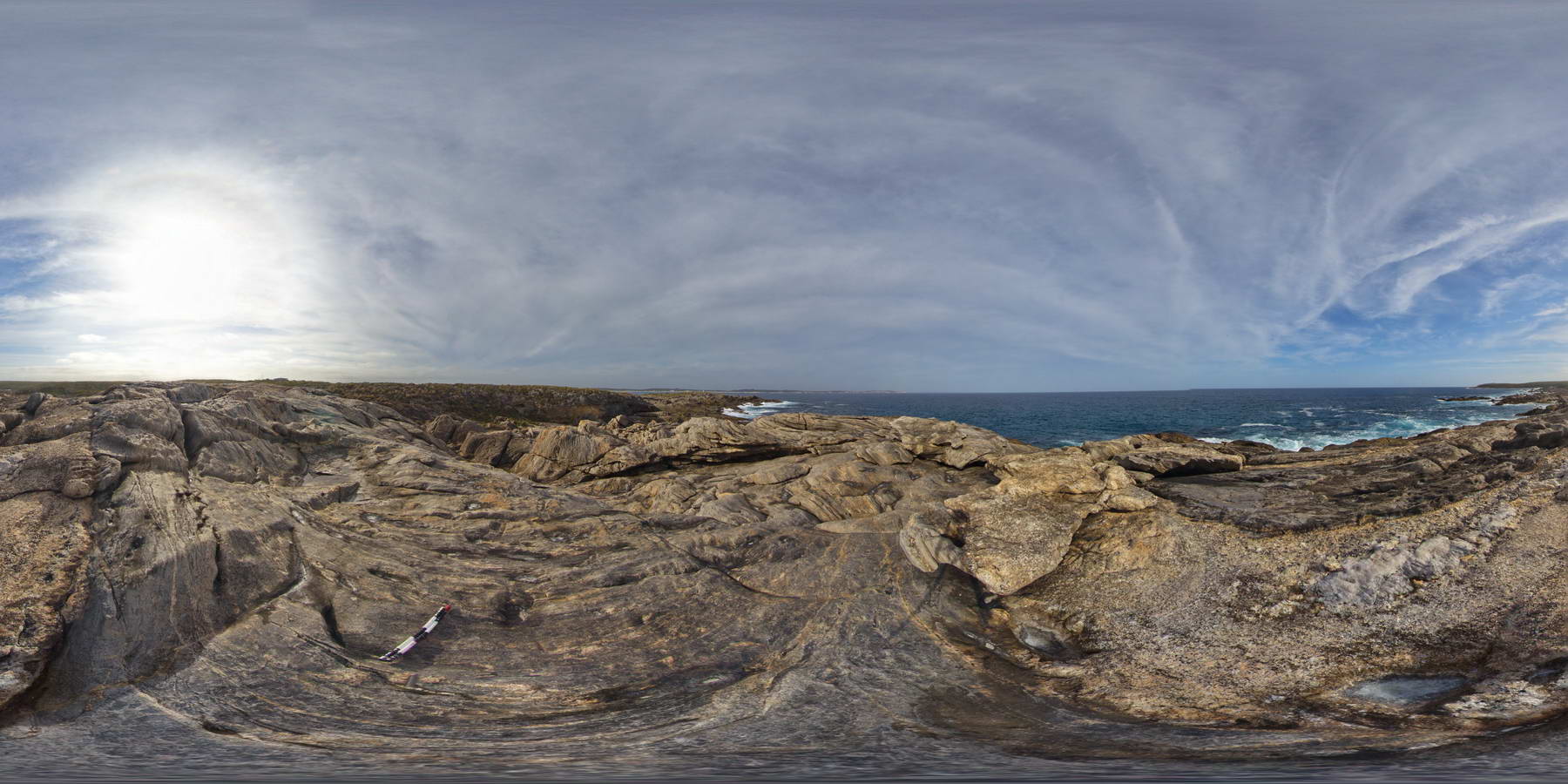
view of shore platform of contact between carbonaceous siltstone and sandstones. Prices Point, Tasman Peninsula, Tasmania. |
250.00 |
-43.03404100000 |
147.74658500000 |
0.500 |
Triassic sedimentary rocks, fluvial facies, sedimentology |
sandstone |
PricesFSP7 Map
 |
20 |
01/01/9999 midnight |
FSP |
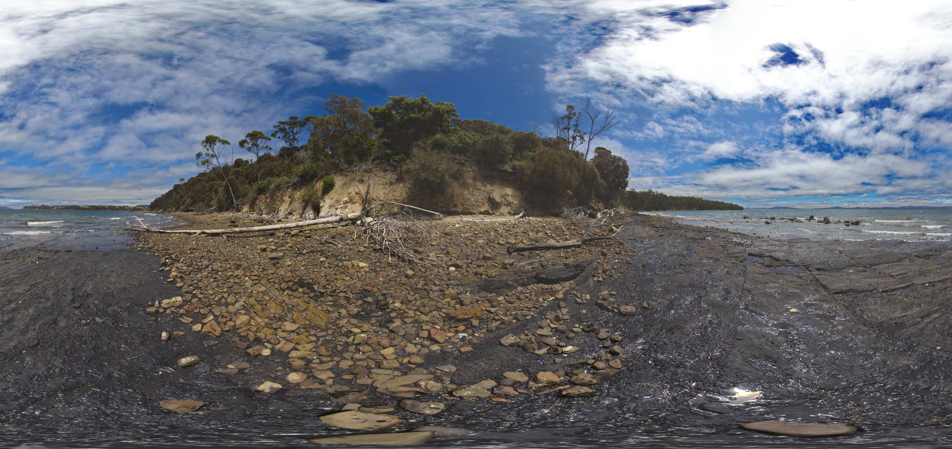
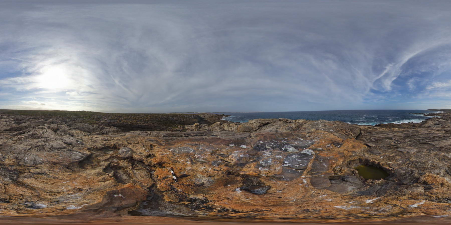
view along shore of contact between underlying dark carbonaceous siltstone and overlying siltstone. Prices Point, Tasman Peninsula, Tasmania. |
250.00 |
-43.03478900000 |
147.74734900000 |
0.500 |
geological contact, carbonaceous siltstone, sedimentological |
siltstone |
PricesFSP8 Map
 |
20 |
01/01/9999 midnight |
FSP |
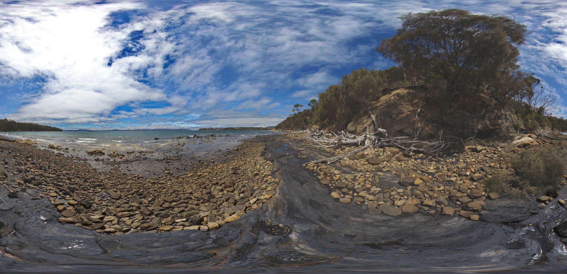
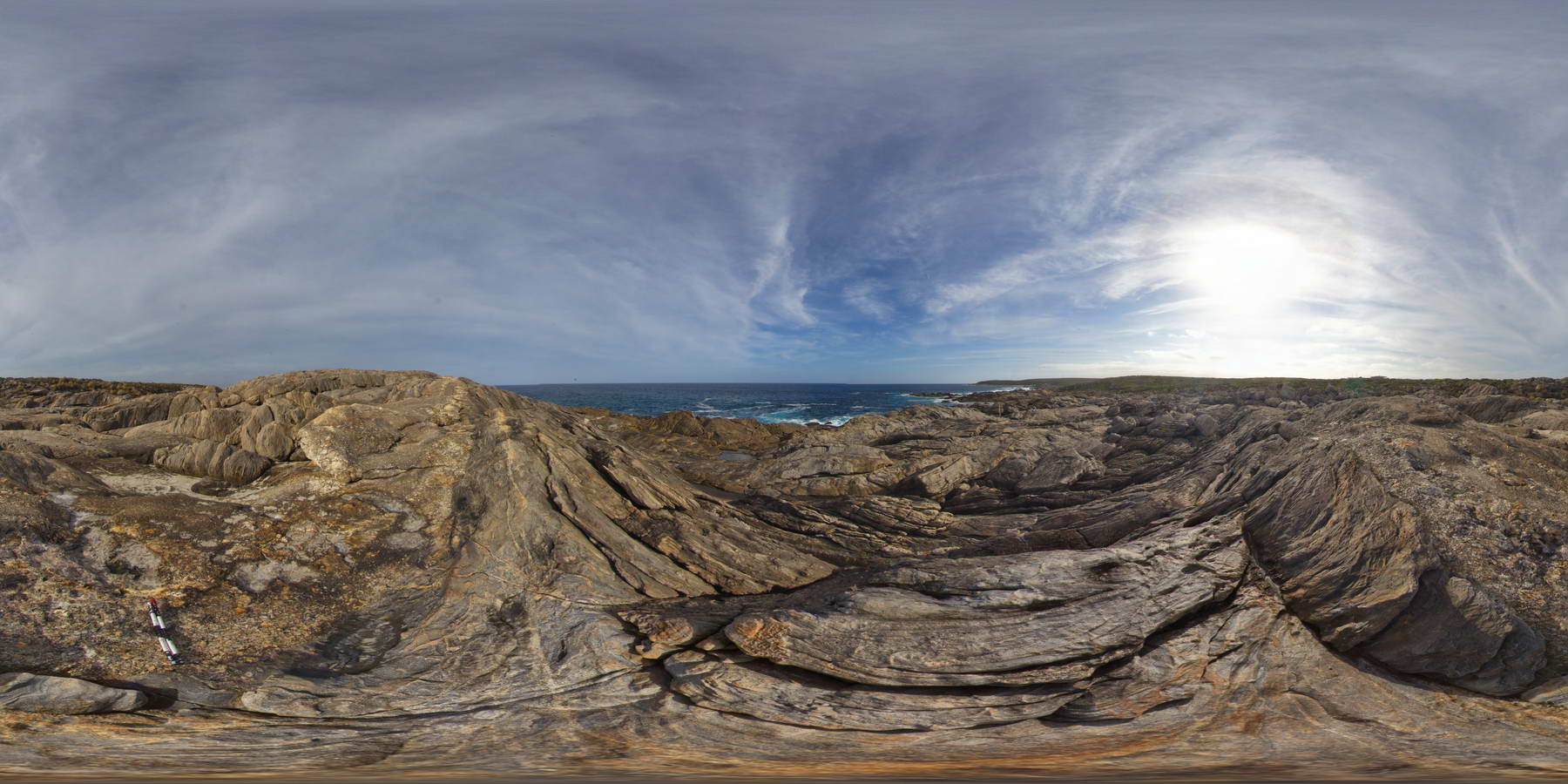
view along shore of contact between underlying dark carbonaceous siltstone and overlying siltstone. Prices Point, Tasman Peninsula, Tasmania. |
250.00 |
-43.03478900000 |
147.74734900000 |
0.500 |
carbonaceous siltstone, sedimentology |
siltstone |
PricesFSP9 Map
 |
20 |
01/01/9999 midnight |
FSP |
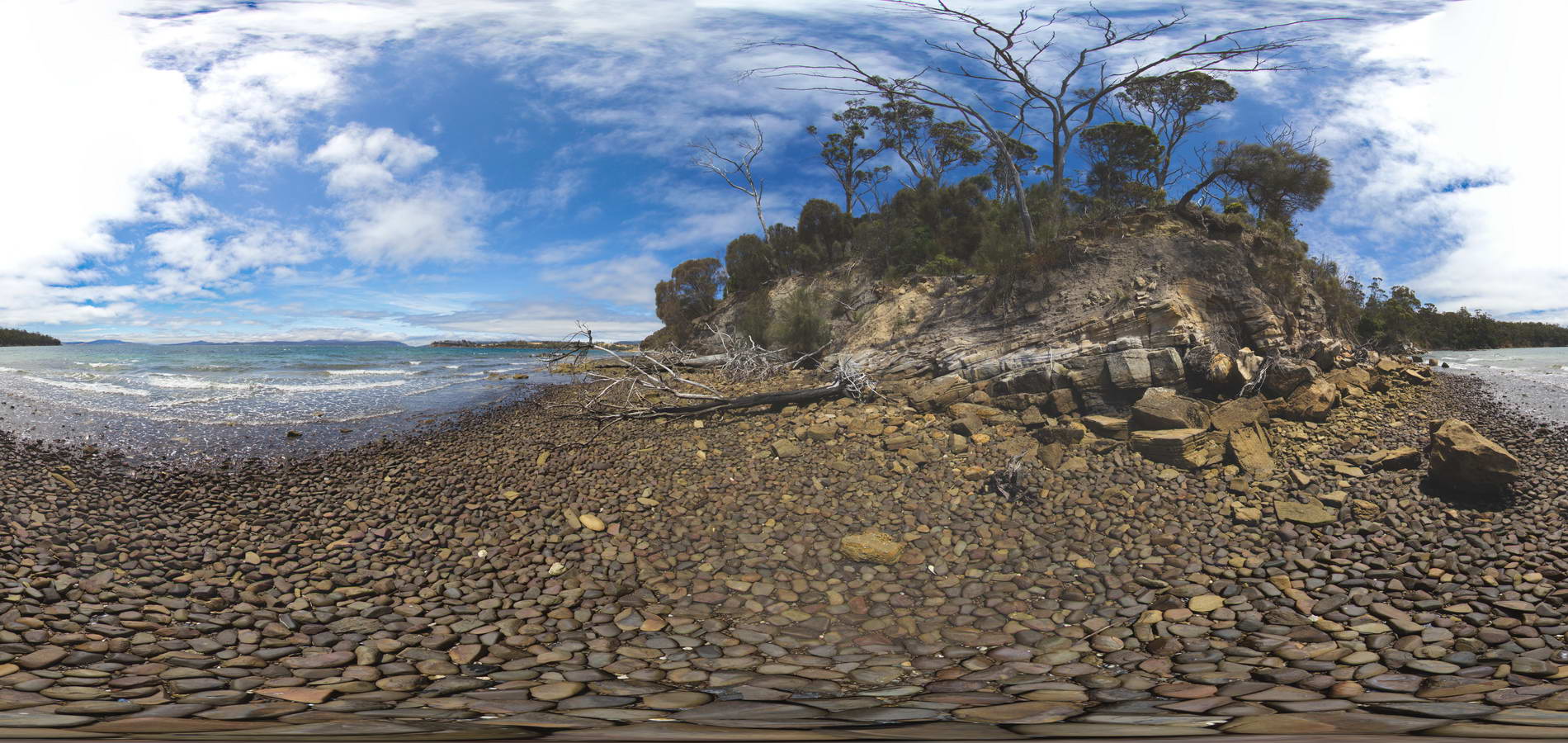
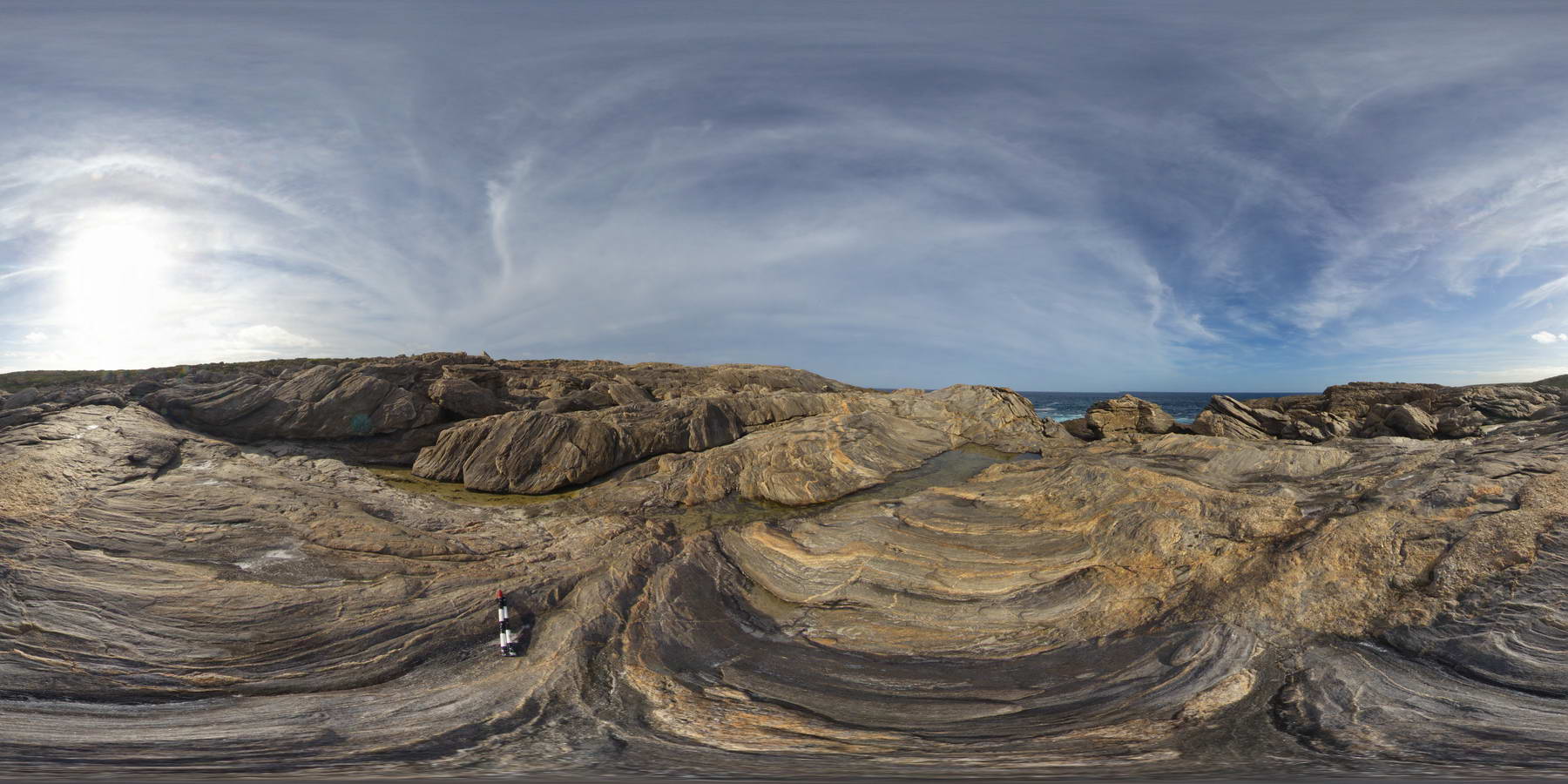
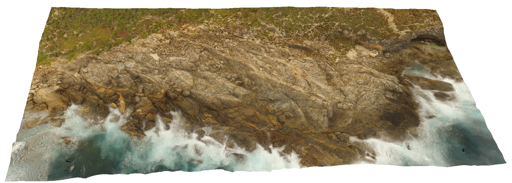
Cross beds and channels in Triassic fluvial sediments. Prices Point, Tasman Peninsula, Tasmania. |
250.00 |
-43.03379200000 |
147.74610800000 |
0.500 |
cross bedding, channel sedimentary facies |
sandstone |
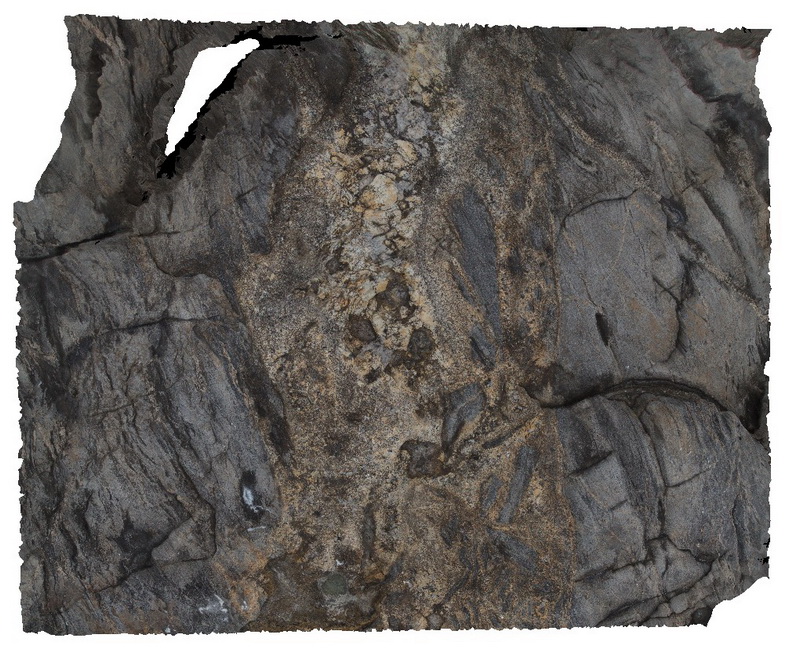
PtEllen1 Map
 |
0 |
10/20/2015 3:35 p.m. |
3D |
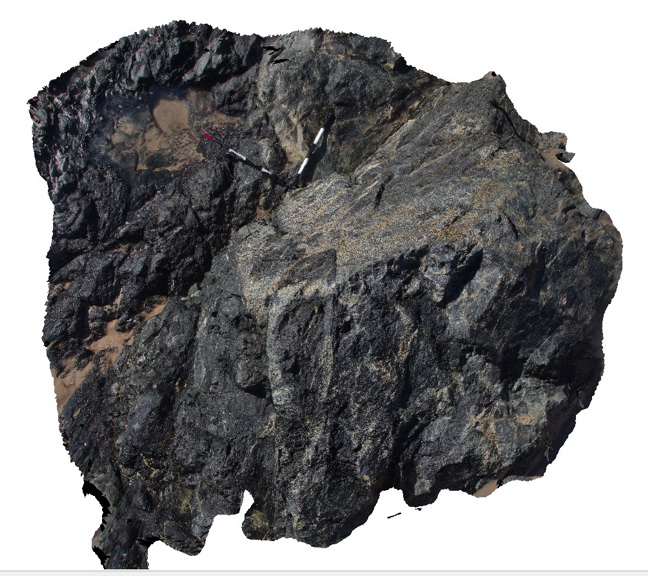
pegmatite dyke with multiple opening events and wall rock brecciation, Point Ellen, Kangaroo Island. |
7.00 |
-35.99876000000 |
137.18636000000 |
-9999.000 |
pegmatite dyke, brecciation |
sediment, pegmatite |
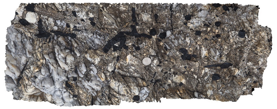
PtEllen2 Map
 |
0 |
10/20/2015 3:38 p.m. |
3D |
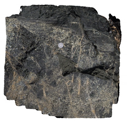
margin of pegmatite dyke, showing folded metasediments, clasts, tourmaline and 2 pegmatite phases, Point Ellen, Kangaroo Island. |
1.00 |
-35.99874000000 |
137.18628000000 |
-9999.000 |
metasediments, intrusive contact, pegmatite dyke, tourmaline |
sediments, pegmatite |
PtEllen3 Map
 |
0 |
10/20/2015 3:40 p.m. |
3D |
large tourmaline aggregates in pegmatite. Point Ellen, Kangaroo Islands. |
0.00 |
-35.99869000000 |
137.18626000000 |
-9999.000 |
pegmatite, tourmaline |
pegmatite |
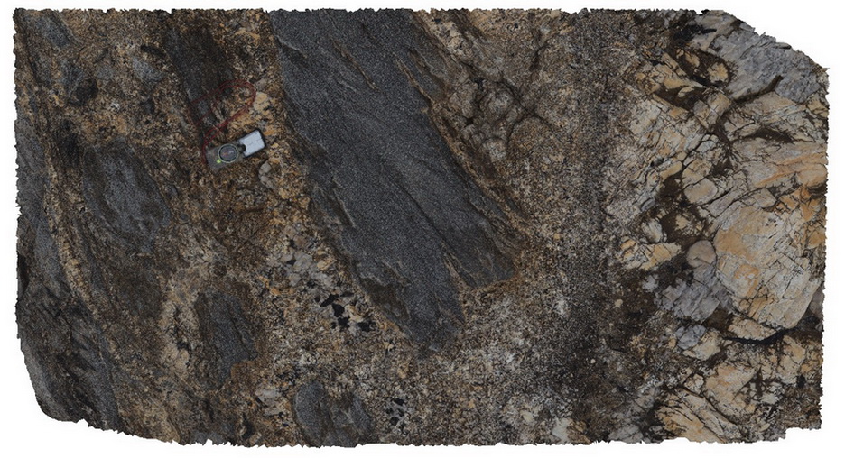
PtEllen4 Map
 |
0 |
10/20/2015 3:41 p.m. |
3D |
migmatised and faulted metasediments of the Kanmantoo Group, Point Ellen, Kangaroo Island. |
0.50 |
-35.99922000000 |
137.18529000000 |
-9999.000 |
migmatised, metasediments |
sediments |
PtEllen5 Map
 |
0 |
10/20/2015 3:41 p.m. |
3D |
detail of migmatised sediments, Point Ellen, Kangaroo Island. |
0.30 |
-35.99922000000 |
137.18529000000 |
-9999.000 |
migmatite, metasediments |
sediments |
PtEllen6 Map
 |
0 |
10/20/2015 3:43 p.m. |
3D |
angular unconformity between the moderately dipping Kanmantoo metasediments and the Pleistocene calcarenous sands above. Point Ellen, Kangaroo Island. |
10.00 |
-35.99833000000 |
137.18684000000 |
-9999.000 |
unconformity, metasediments, calcarenous sands |
sediment, calcarenous sands |
PtEllen7 Map
 |
0 |
10/20/2015 3:43 p.m. |
3D |
unconformity between the Kanmantoo metasediments, with stockwork veining and pegmatites and the overlying calcareous sands. Point Ellen, Kangaroo Island. |
5.00 |
-35.99822000000 |
137.18686000000 |
-9999.000 |
unconformity, metasediments, veining |
sediments, pegmatite, sandstone |
PtEllen8 Map
 |
0 |
10/20/2015 3:45 p.m. |
3D |
unconformity between steeply dipping metasediments of the Kanmantoo Group and the overlying shelly sands. Point Ellen, Kangaroo Island. |
0.50 |
-35.99830000000 |
137.18683000000 |
-9999.000 |
shelly, unconformity, metasediments |
sandstone, sediment |
PtEllen9 Map
 |
0 |
10/20/2015 3:45 p.m. |
3D |
detailed view of shelly limestone and clasts of basement. Point Ellen, Kangaroo Island. |
0.30 |
-35.99841000000 |
137.18669000000 |
-9999.000 |
bioclastic limestone, shelly, basement clasts |
limestone, sediment |
PtEllenFSP1 Map
 |
0 |
10/20/2015 3:46 p.m. |
FSP |
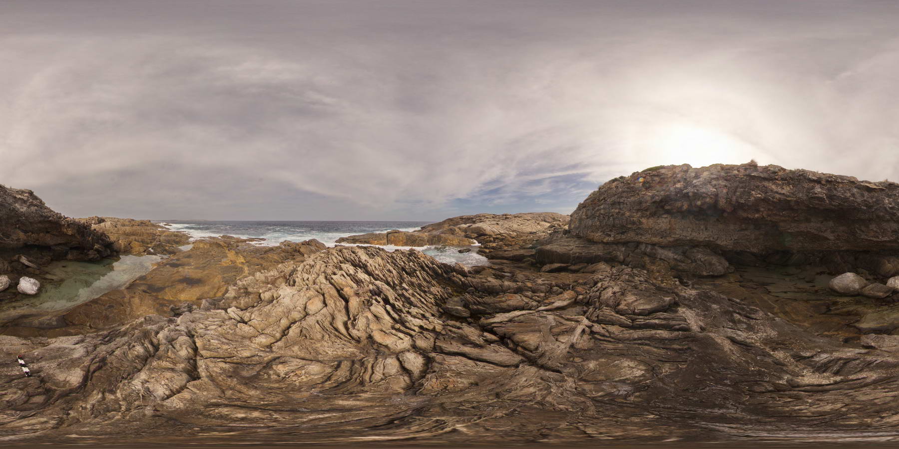
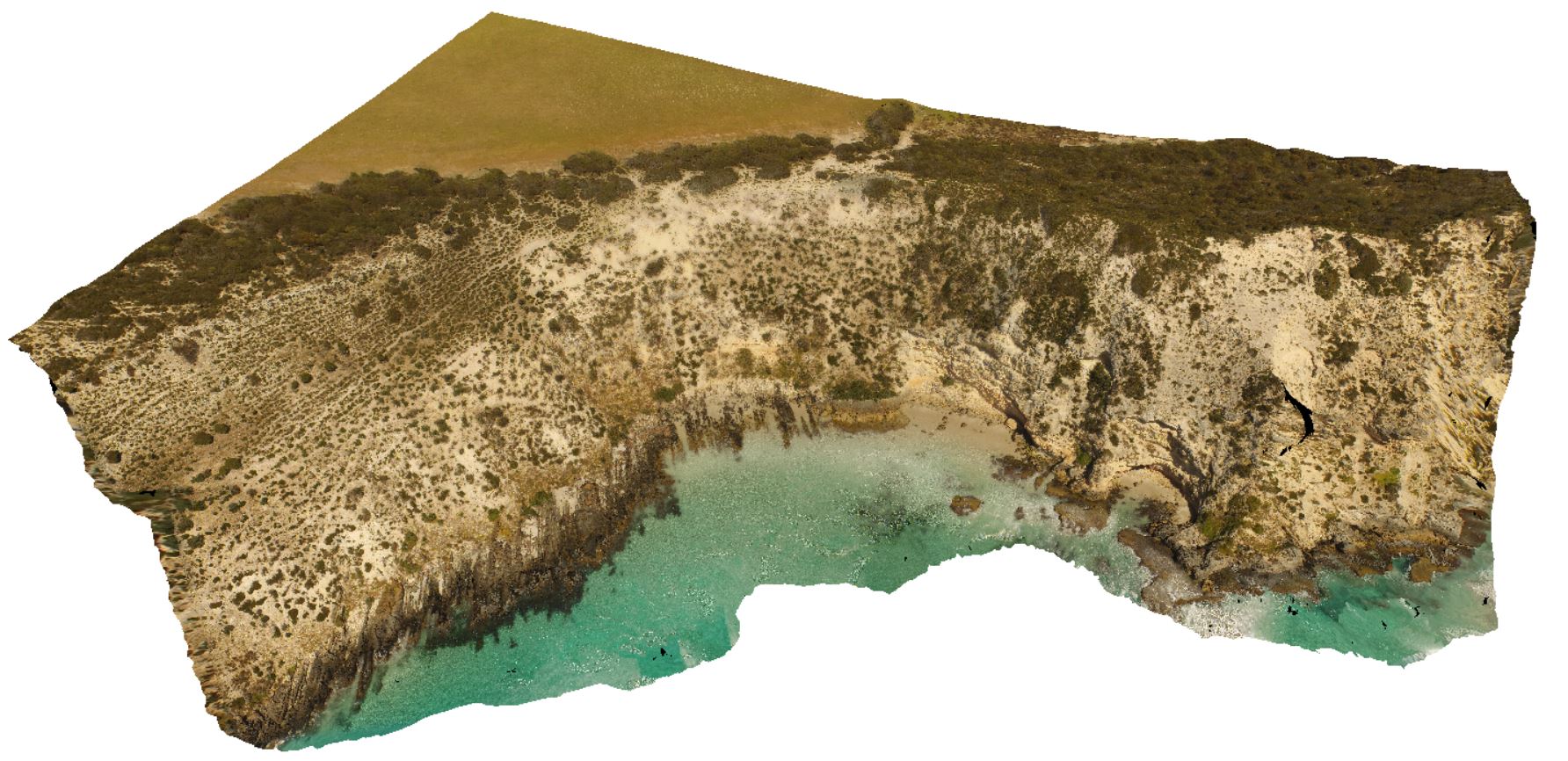
shoreline exposure showing folded and multiply intruded metasediments of the Kanmantoo Group, overlain by flat to gently dipping Pleistocene sediments. Point Ellen, Kangaroo Island. |
200.00 |
-35.99817000000 |
137.18700000000 |
-9999.000 |
unconformity, folded, dyke, metasediment |
sediment, pegmatite, sandstone |
PtEllenFSP2 Map
 |
0 |
10/20/2015 3:46 p.m. |
FSP |
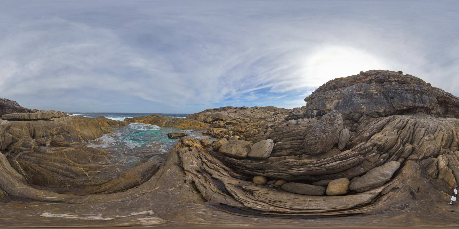
shore exposure showing steeply dipping metasediments that have been intruded by pegmatite dykes and quartz veins, unconformably overlain by calcareous sandstone, Point Ellen, Kangaroo Island. |
300.00 |
-35.99829000000 |
137.18687000000 |
-9999.000 |
unconformity, metasediments, pegmatite dyke, calcareous sands |
sediments, pegmatite, sandstone |
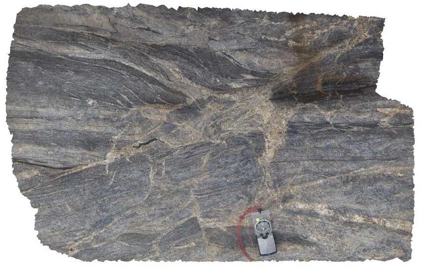
PtEllenFSP3 Map
 |
0 |
10/20/2015 3:46 p.m. |
FSP |
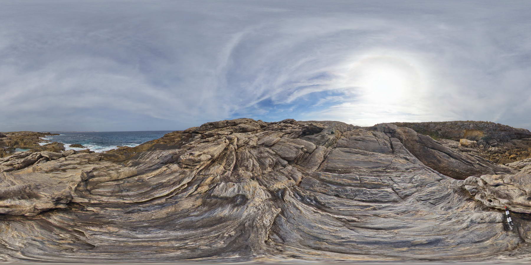
shore exposure of moderately dipping metasediments of the Kanmantoo Group, intruded by pegmatite dykes and quartz veins. Point Ellen, Kangaroo Island. |
1000.00 |
-35.99859000000 |
137.18686000000 |
-9999.000 |
intrusive contact, metasediment, quartz vein |
sediment, pegmatite |
PtEllenFSP4 Map
 |
0 |
10/20/2015 3:46 p.m. |
FSP |
multiply deformed metasedimentary rocks of the Kanmantoo Group, intruded by pegmatite dykes and quartz veins. Point Ellen, Kangaroo Island. |
1000.00 |
-35.99886000000 |
137.18652000000 |
-9999.000 |
metasediment, pegmatite dyke, intrusive contact |
sediment, pegmatite |
PtEllenFSP5 Map
 |
0 |
10/20/2015 3:46 p.m. |
FSP |
wall rock xenolith in pegmatite dyke intruding Kanmantoo metasediments. Point Ellen, Kangaroo Island. |
2000.00 |
-35.99879000000 |
137.18634000000 |
-9999.000 |
xenolith, intrusive contact, pegmatite, metasediment |
pegmatite, sediment |
PtEllenFSP6 Map
 |
0 |
10/20/2015 3:46 p.m. |
FSP |
shore exposure, showing pegmatite dyke intruding the deformed Kanmantoo metasediments. Point Ellen, Kangaroo Island. |
2000.00 |
-35.99886000000 |
137.18610000000 |
-9999.000 |
intrusive contact, pegmatite dyke, metasediments |
sediments, pegmatite |
PtEllenFSP7 Map
 |
0 |
10/20/2015 3:47 p.m. |
FSP |
shore exposure, showing pegmatite dyke intruding the deformed Kanmantoo metasediments with abundant quartz veining. Point Ellen, Kangaroo Island. |
100.00 |
-35.99904000000 |
137.18578000000 |
-9999.000 |
intrusive contact, pegmatite dyke, metasediment, quartz veining |
sediment, pegmatite |
PtEllenUAV1 Map
 |
0 |
10/20/2015 3:47 p.m. |
UAV |
aerial view of deformed Kanmantoo metasediments, with cross cutting dykes. Point Ellen, Kangaroo Island. |
300.00 |
-35.99885900000 |
137.18634400000 |
-9999.000 |
metasediments, dyke |
sediments |
PtEllenUAV2 Map
 |
0 |
10/20/2015 3:47 p.m. |
UAV |
aerial view of the angular unconformity between the underlying Kanmantoo metasediments and the overlying Pleistocene sands. Point Ellen, Kangaroo Island. |
1000.00 |
-35.86015600000 |
137.73456900000 |
-9999.000 |
angular unconformity, metasediments, sandstone |
sediments, sandstone |
PtMacquarie1 Map
 |
5 |
01/01/9999 midnight |
3D |
Mafic dyke cross-cutting layered cherts within the Port Macquarie Serpentinite melange |
8.00 |
-31.43030000000 |
152.92386000000 |
1.000 |
dyke, structure |
chert, dolerite |
PtMacquarie10 Map
 |
5 |
01/01/9999 midnight |
3D |
Variably serpentinised mafic and ultramafic rocks within the Cambrian Port Macquarie Serpentinite |
2.00 |
-31.42979000000 |
152.92174000000 |
0.000 |
ultramafic, melange, serpentine, igneous, structure |
ultramafic |
PtMacquarie11 Map
 |
5 |
01/01/9999 midnight |
3D |
Detailed view of the mafic and ultramafic rocks displayed in PtMac10. Cambrian Port Macquarie Serpentinite |
1.00 |
-31.42979000000 |
152.92174000000 |
0.000 |
ultramafic, igneous, veins, structure |
ultramafic |